


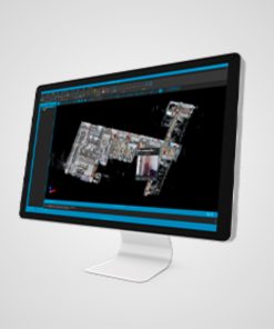

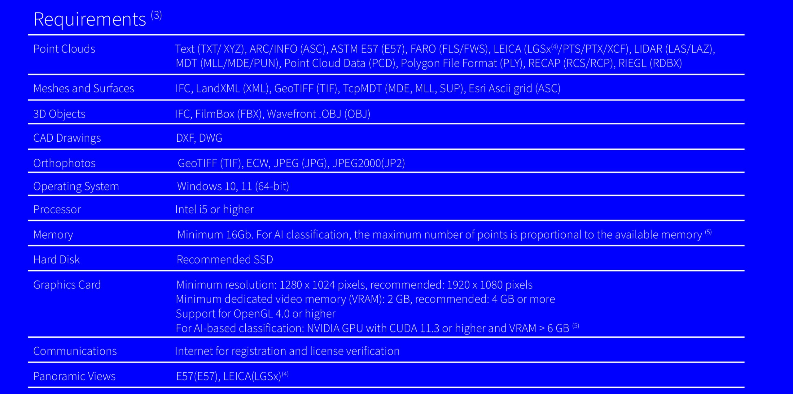
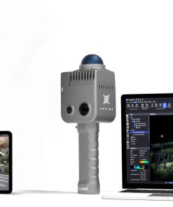
Management of Points and Images
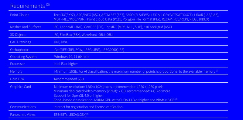
- Point clouds and images in the most common formats on the market can be imported.
- Attributes such as color, intensity, time, category and returns are also converted.
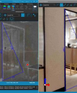
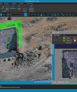
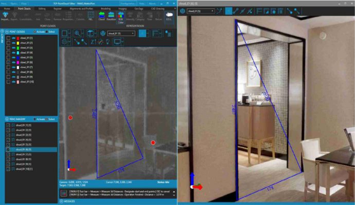
- It is possible to measure, vectorize and draw accurately in 3D on the points or images, with its built-in CAD or synchronizing with an external one.
- It is also allowed to register several clouds through control points and apply coordinate transformations.
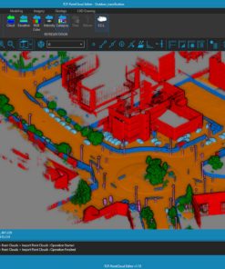
Classification, Filtering, and Editing
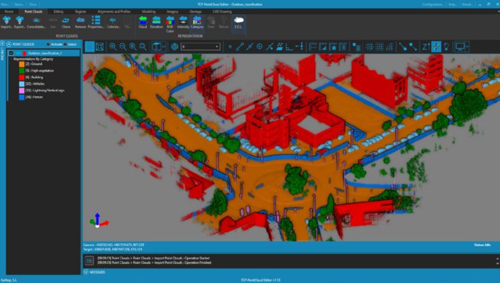
- The application includes Artificial Intelligence models trained to classify
points in indoor and outdoor scenes, as well as advanced methods for
segmentation and selection of planes, objects, terrain, etc. - It also offers filtering tools for noise removal, selection by geometry or
attributes, and manual editing.
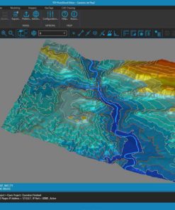
Digital Models
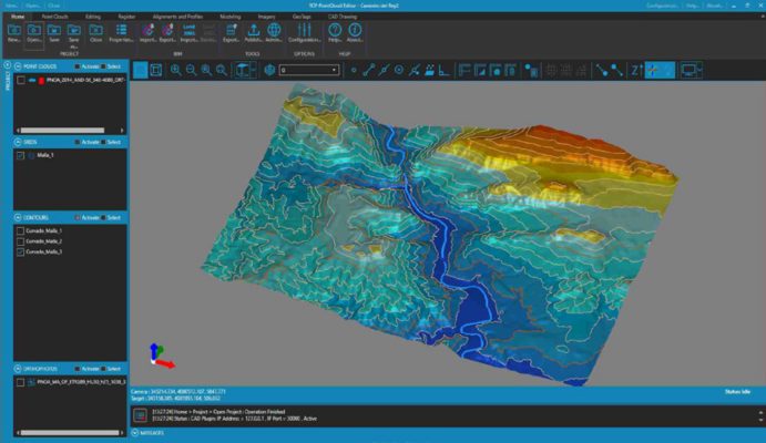
- With the point cloud you can create a surface or mesh and generate
the contour lines. - The symbology of models can be based on their
elevations, slopes, orientations, shading or orthophotos. - Meshes can be edited interactively or apply smoothing, peak removal, etc.
- You can also import and export surfaces and meshes, as well as 3D models in various formats
Profiles and Volumes
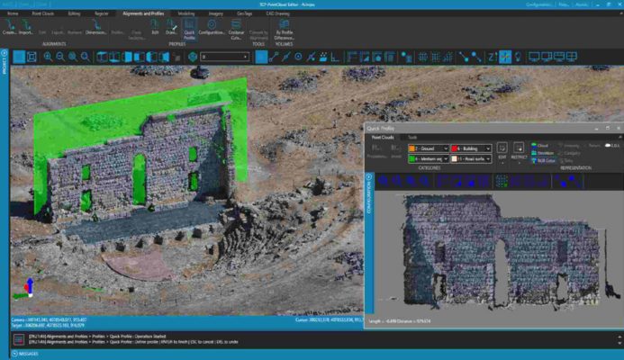
- The application has tools to calculate a quick profile from the point clouds or the model.
- It is also possible to obtain a longitudinal profile and cross-sections along an alignment and draw 3D polylines on the profile.
- Top view sections are especially useful for building projects.
- Volumes of stockpiles defined by a polyline or layer can be quickly calculated, as well as surfaces and cut and fill volumes between models.
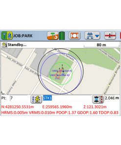
SHARING AND PUBLISHING
- Data can be imported and exported in common industry formats and it is compatible with CAD, BIM, and GIS software.
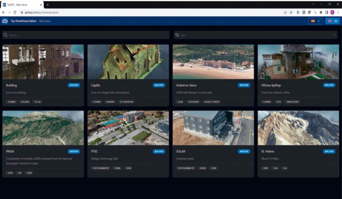
- Projects can be published to the cloud (2) and viewed with a web viewer on any device.
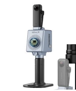
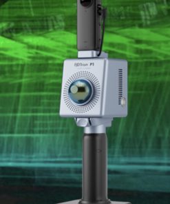
About the product
- Import clouds from standard formats and represent by attributes such as color, intensity, category, etc.
- Measure and draw comfortably and intuitively in 3D on the cloud or 360º image.
- Creates plan and elevation profiles and includes vectorization tools.
- Classifies points of interior and exterior scenes with Artificial Intelligence.
- Noise removal, advanced selection and manual editing tools available.
- Easily manage geo-tags
- Generates 3D surfaces or meshes and calculates volumes
- Compatible with CAD, BIM and GIS software
- Publish projects in the cloud that can be viewed with a web viewer from any device
Want resell this product and earn provision from sells?
Check our Affiliate Program by clicking on bellow graphic

| Choose Version | 12 Months Licence, Permanent Licence |
|---|
Tylko zalogowani klienci, którzy kupili ten produkt mogą napisać opinię.
Może spodoba się również…
-21%
FJDYNAMICS
-19%
-11%
FJDYNAMICS
Podobne produkty
-33%
Brak w magazynie
-31%
-31%
Brak w magazynie
Kontrolery
-3%
Brak w magazynie
-18%
-23%
Opinie
Na razie nie ma opinii o produkcie.