-13%
-14%
SPECIAL PROMOTIONS FOR 3D SLAM SCANNERS - ACCESORIES WORTH 5000EUR GRATIS WITH ANY 3D SLAM Odrzuć
Skip to contentBrak produktów w koszyku.
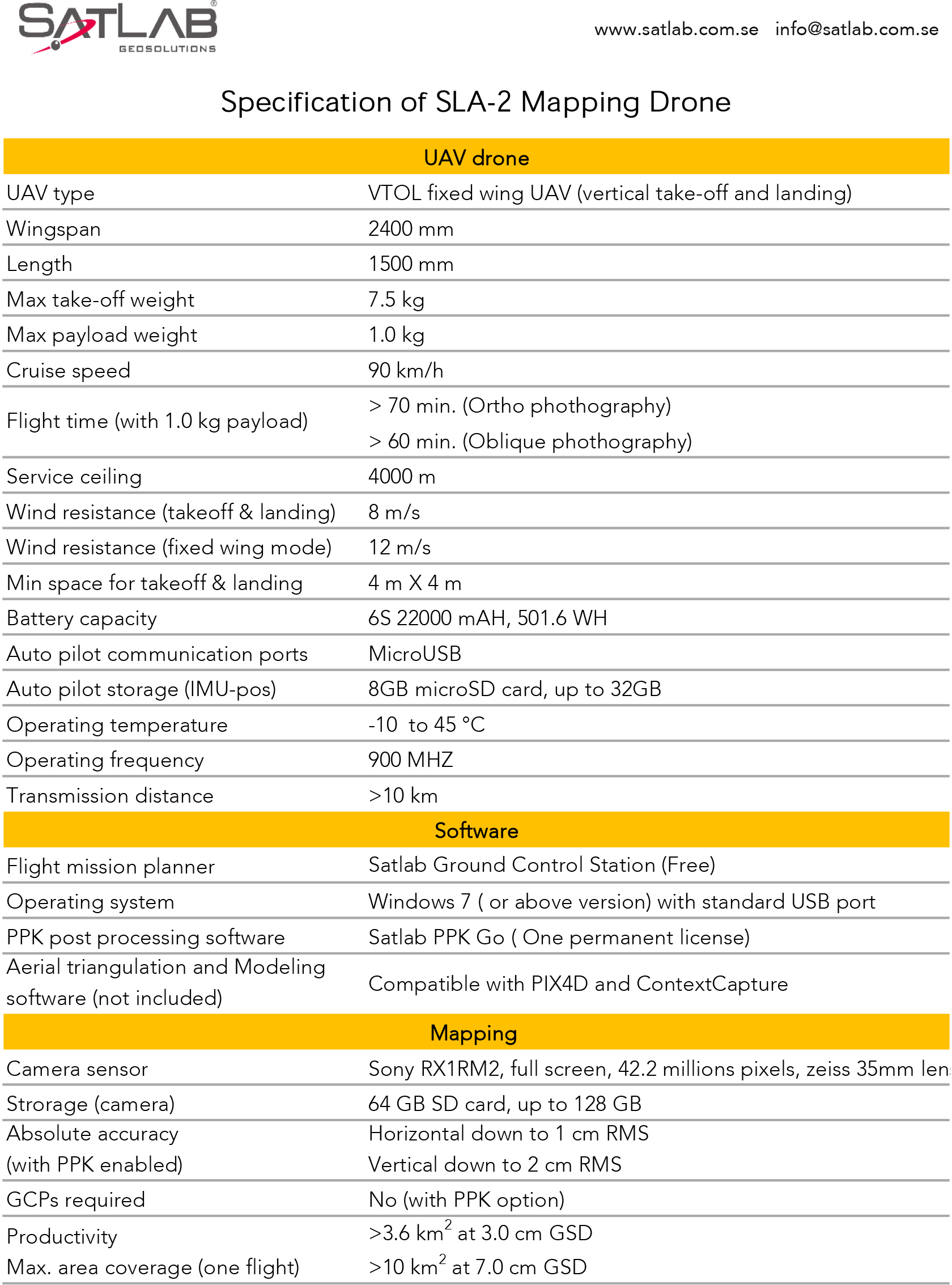
Drone Mapping is Designed and developed for vertical take-off and landing, the drone mapping SLA-2 is a fully autonomous UAV capable of up to 75 minutes of flight time. This industrial quality UAV allows a maximum payload of 1kg with a cruise speed of 80km/h.
The Satlab SLA-2 drone mapping is a photogrammetry UAS delivering high accuracy point cloud and orthophoto. With a highly optimized airframe, it features detachable pieces for easy transportation and operation. This model also has an advanced autopilot system that ensures safe operation at ease.
Plan and upload your mission route to the drone mapping SLA-2 autopilot using the Mission Planning Software.
The SLA-2 has an integrated dual frequency RTK (GPS/GLONASS/BEIDOU) receiver which reduces the number of Ground Control Points (GCPs) required. There is a safety feature with a motor placed in the pusher configuration AFT of airframe, that significantly reduces the risk of an accident.

Płatowce UAV
Kontrolery
ODBIORNIKI GNSS
ODBIORNIKI GNSS
Odbiorniki
ODBIORNIKI GNSS